Gathering the latest information…
WEATHERTrackCAST
Your Online Weather Tracking Source
Severe Center
Severe Center
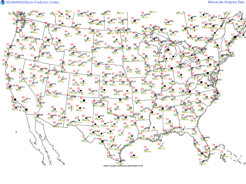
Mesoscale Analysis - Regional Surface Chart
Map
Additional Types
Additional Types:
-----------------------
Regional Surface Chart
Visible Satellite Image
Base Reflectivity Mosaic
Watch/Warning Summary
MSL Pressure/Wind
T / Td / Wind
Moisture Convergence
ThetaE Advection
2hr Pres Change
850 Mb Analysis
700 Mb Analysis
500 Mb Analysis
300 Mb Analysis
850 & 500 Mb Winds
Deep Moisture Conv
Precipitable Water
SBCAPE / CIN
100mb MLCAPE
MUCAPE / LPL Height
SB Lifted Index / CINH
3km Cape & Sfc Vort
Mid Level Lapse Rates
Low Level Lapse Rates
Normalized CAPE
Downdraft CAPE
0-6km Shear Vector
Effective Shear
BRN Shear
0-1km SR Helicity
0-3km SR Helicity
Effective SR Helicity
0-1km Shear Vector
0-2km SR Winds
4-6km SR Winds
9-11km SR Winds
Anvil Level SR Winds
Supercell Composite
Craven SigSvr
3km EHI
1km EHI
LFC Height
LCL Height
LCL-LFC RH
Hail Parameters
Additional Locations
Additional Locations:
-----------------------
National
Northeast
East Central
South East
South Central
Central
North Central
Northwest
West Central
Southwest